Swiftmaps Europe Wall Map GeoPolitical Edition SM EUR SM L
Lonely Planet Europe Planning Map
Europe Map (National Geographic Adventure Map, 3328)
Europe Map | Geography Posters | Gloss Paper measuring 850mm x 594mm (A1) | Geography Classroom Posters | Education Charts by Daydream Education
2025 Philip's Big Road Atlas of Europe: (A3 Spiral Binding) (Philip's Road Atlases)
Rick Steves Europe Planning Map: Including London, Paris, Rome, Venice, Florence, Amsterdam, Vienna & Prague City Maps
Lonely Planet Global Limited Europe Planning Map
Maps International Large Europe Wall Map (political) - Front Sheet Laminated - 118.9cm (w) x 84.1cm (h) Map – Wall Map, 1 January 2019
Vintage Map of Europe Travel World Political Map Cities in Detail Map Posters for Wall Map Art Wall Decor Geographical Illustration Tourist Travel Destinations Cool Wall Art Print Poster 12x18
Map of Europe Childrens Pupils Teachers Classroom Display Poster A2 Primary Teaching Services
Europe Wall Map GeoPolitical Edition by Swiftmaps (18x22 Laminated)
Maps International - Scratchable map, European edition, detailed cartography to the maximum
Philip's Europe Road Map (Philip's Sheet Maps)
Funito Scratch Off Map of The World with Flags - 83 * 60cm Easy to Frame Scratch Off World Map Wall Art Poster with US States & Flags - Deluxe World Map Scratch Off Travel Map Designed for Travelers
Lonely Planet Europe Planning Map
Streetwise Europe & Major Rail Routes Laminated Map (Michelin Streetwise Maps)
Europe Wall Map Political - Educational Learning - Updated 2024 - Laminated - 59 x 42 cm - Maps International
Michelin Europe Map 705 (Maps/Country (Michelin))
Philip's Maps2025 Philip's Easy to Read Multiscale Road Atlas Europe: (A4 Spiral binding) (Philip's Road Atlases)
National Geographic Europe Map (folded with flags and facts) (National Geographic Reference Map)
Great Britain Planning Map
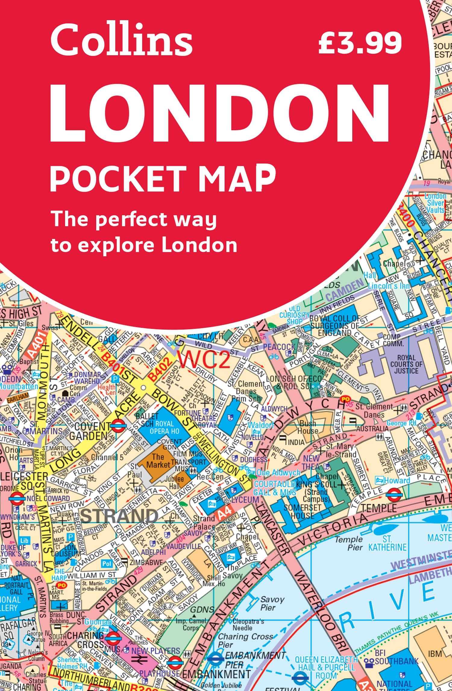
Collins London Pocket Map: The Perfect Way to Explore London Map – Folded Map, 6 February 2020
Painless Learning M. Ruskin Europe Map Placemat (EUR-1)
Scratch off Map of the Europe - Easy to Frame 24x16 European Travel Map Poster with Cities - Large Black and Gold Push Pin Travel Wall Maps - Scratchable Europe Map with Scratcher Included
2025 Philip's Big Road Atlas of Europe
National Geographic: Europe Executive Enlarged Wall Map (46 x 35.75 inches) (National Geographic Reference Map)
KEIUNDJK Political Map of Europe Poster Style-1 16x24inch(40x60cm)
Europe Map - EXTRA LARGE 33” x 23.5” - Gloss Paper - Geography Middle & High School Classroom Decoration - Map of Europe Wall Chart by Daydream Education
KEIUNDJK Political Map - Map of Europe 2012 Thefreebiedepot Style 16x24inch(40x60cm)
THINK2MASTERColorful Map of Europe 250 pieces Jigsaw Puzzle fun educational toy for kids, school & families. Great gift for boys & girls ages 8+ for learning European History. Size: 14.2” X 19.3”
National Geographic Europe Wall Map - Executive - Laminated (30.5 x 23.75 in) (National Geographic Reference Map)
National Geographic: Europe Classic Wall Map - Laminated (30.5 x 23.75 inches) (National Geographic Reference Map)
BULOR Europe Map Tapestry Wall Hangings EU Euro Vintage Map with Countries Cities Tapestry For Kids Student Bedroom Living Room Dorm Cave Background 60x40inch
Scratch Off Map Of Europe – Color Europe Wall Map – Scratch Off – 23 x 33
CoolOwlMaps Europe Continent Wall Map Poster - Laminated 32x24
AllPosters Wall Poster Map of Europe, 36x24
GeoToys GeoPuzzle, Europe Shaped Jigsaw Puzzles, 58 Pc Geography Puzzle, Geography Game & Map Puzzle, Jigsaw Puzzles for Kids Ages 6-7-8-9 Years Old
Rail Map of Europe with Ferry Routes Map – April 1, 2017
National Geographic: Europe Classic Political Wall Map - 30.5 x 24 inches - Art Quality Print
Europe Map Classroom Poster - EXTRA LARGE 33” x 23.5” - Laminated - Map of Europe Geography Class Decoration - Wall Chart by Daydream Education.
Cavallini & Co. Decorative Paper Sheet, Europe Map, 20 x 28 inch Italian Archival Paper (WRAP/MAPEUR3)…
National Geographic Europe Wall Map - Executive (30.5 x 23.75 in) (National Geographic Reference Map)
Map of Europe 18x24 - Laminated Wall Map Poster Print Perfect for Classrooms and Homes - Vivid Imagery with Bright Colors
GeoMetro - Large map of Europe (35 x 48 inches) full lamination, countries with the euro, members of the European Union Map – Wall Map, January 1, 2023
Maps International Large Political Europe Educational Wall Map Poster - Front Sheet Laminated - 33.1 x 46.8 inches
Teacher Created ResourcesEurope Map Chart, Multi Color (7654)
Poster Master Map Poster - Bacon's Standard Map Of Europe Print - Time Zones Art - Gift for Men, Women, Students & Teachers - Decor for Classroom, Library, Office or Dorm - 8x10 UNFRAMED Wall Art
National Geographic: Europe Classic Enlarged Wall Map (46 x 35.75 inches) (National Geographic Reference Map)
Global Walkabout Scratch Off Map - Deluxe Travel Size World Map Poster - Countries and Facts - Travel Gift
Edinburgh Pocket Map: The Perfect Way to Explore Edinburgh
Grupo Erik editores Map of Europe – Mini Poster 40x50 cm
Lonely PlanetLonely Planet Scotland Planning Map
Portugal Road Map 1:500 000
Lonely Planet Spain Planning Map
Italy Map (National Geographic Adventure Map, 3304) Map – Folded Map, January 1, 2022
European Country Maps Coloring Book: 46 Blank, Outline and Detailed Country Maps for Coloring, Home, and Education (World of Maps)
Mudpuppy Map Of Europe – 70 Piece Geography Puzzle with Country-Shaped Pieces and Iconic Landscapes Cultural Items And More
Tot Talk Placemat Europe Map Meal Dining Kids Mat tot1077
Picador The Map of Knowledge: How Classical Ideas Were Lost and Found: A History in Seven Cities
Cornwall Pocket Map: The Perfect Way to Explore Cornwall
Germany Physical Poster Map - 16.5 x 23.3 inches - Paper Laminated
Scratch Off World Map - Extra Large - Black and Gold Scratchable World Map Poster - Best Travel World Map Gift - All Accessories - Premium Detailed Scratch Off Map of The World - for Globetrotters
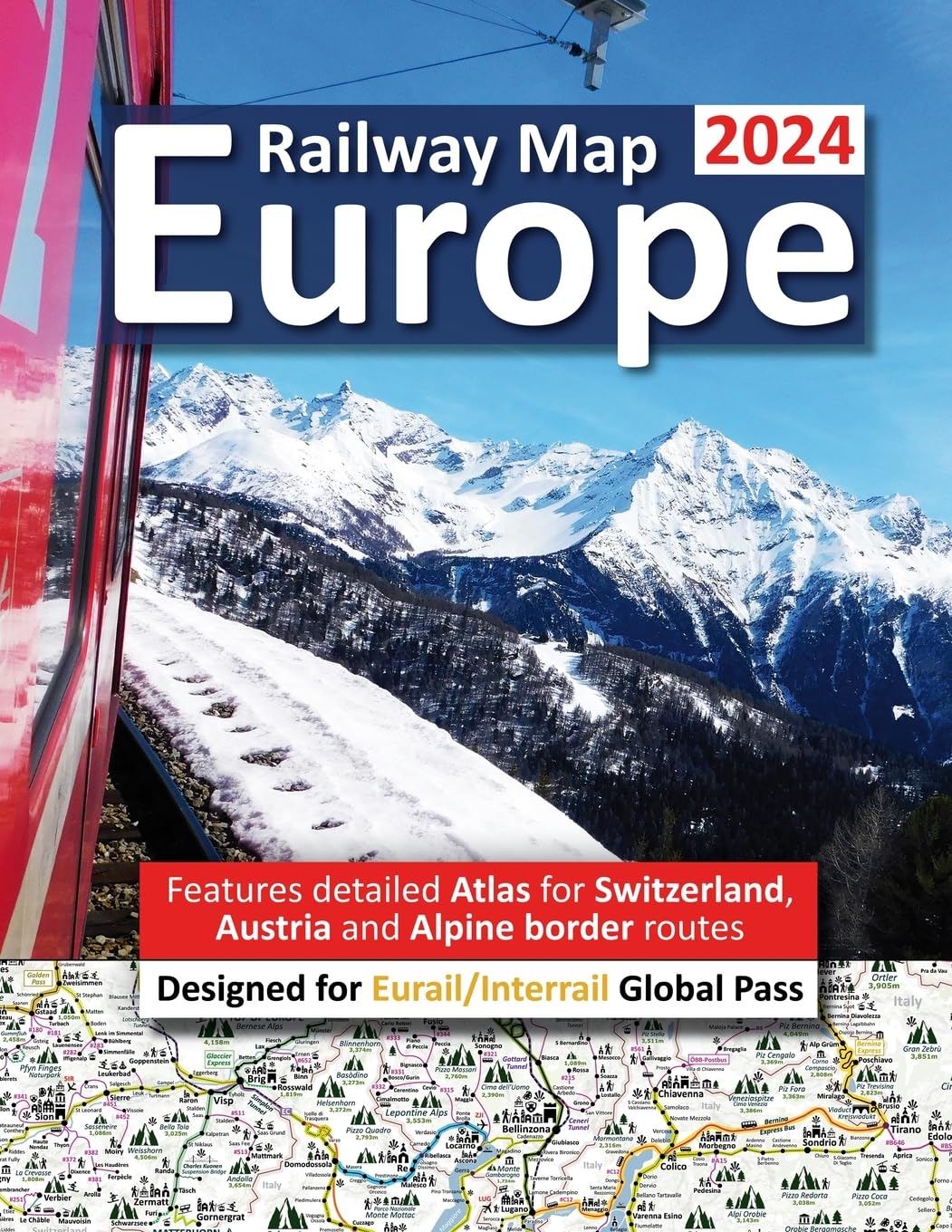
Europe Railway Map 2024 - Features Detailed Atlas for Switzerland and Austria - Designed for Eurail/Interrail Global Pass
A map!: Phase 2 Set 2 Blending practice
Western Europe Rail & Road Travel Reference Map 1:2,500,000
SMAGOS Scratch off European Map with Flags - Scratchable map to mark your travels - Made in Europe - 42 cm x 30 cm, Black,a3,EU-1
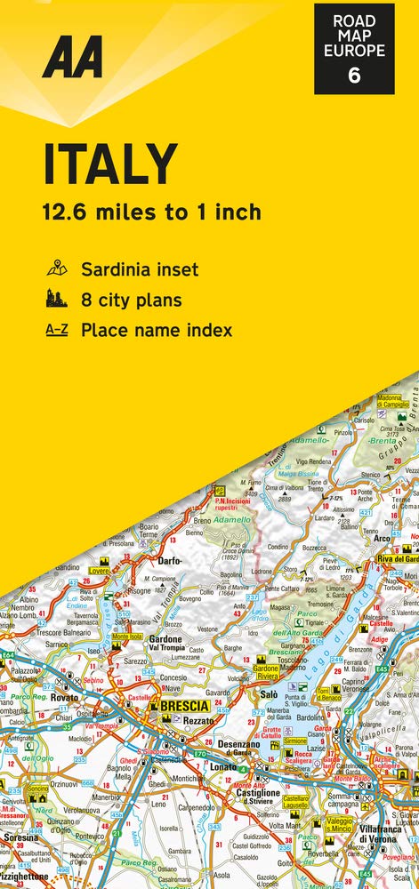
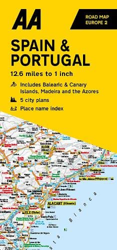
AA Road Map Spain & Portugal
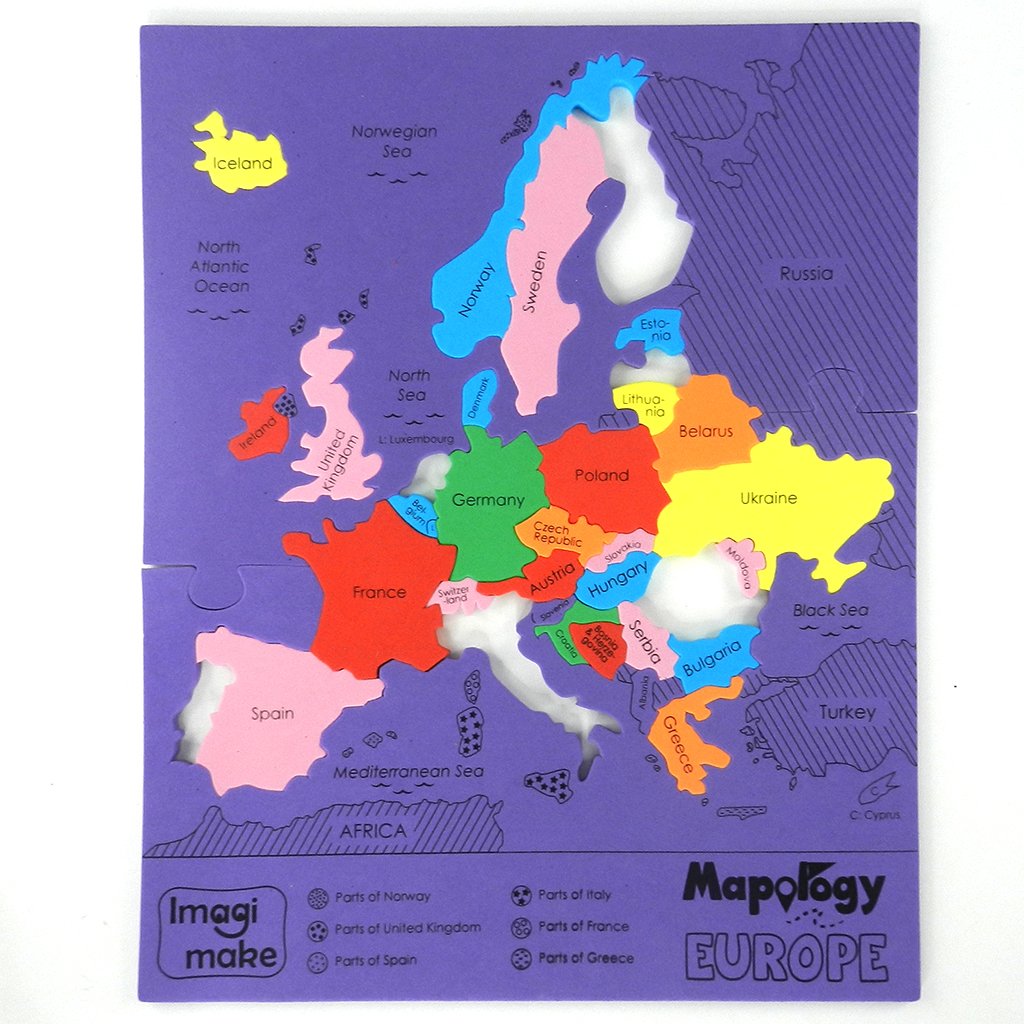
Imagimake Mapology Europe Map Puzzle - Geography for Kids - Learning & Educational Toys - Puzzles for Kids Ages 4-8, Gift for Gift for 4, 5, 6, 7, 8 Year Old
Luckies of London Scratch off Map World Poster, Detailed Map of the World with capitals, states, cities, Scratch Map Deluxe Edition
Europe Geography Activity Book Paperback – February 16, 2022
Germany: Travel Maps International Adventure Map
Jigsaw Puzzles For Adults 1000 Piece Map Of Europe Puzzle - European Jigsaw 1000 Piece Jigsaw Puzzles For Adults And Kids - Geography Gifts by bopster
Scratch Off World Map A3 Travel Size (42 x 29.7cm) + BONUS A4 UK Map - with Accessories Kit and Gift Tube - Deluxe Cartographic design by Atlas&Green
2 x 10cm EU Europe Flag Map Vinyl Sticker Decal Car Laptop European Union #9022 (10cm Wide x 10cm High)
Scratch Off European Football Gift Grounds Map Poster - 59.4cm (w) x 42cm (h)
Little Wigwam World Map "No Tear Guarantee" Educational Poster (60 x 42cm)
Lonely Planet France Planning Map
Loiret, Loir-et-Cher - Michelin Local Map 318: Map
ImagimakeMapology Europe with Capitals - Jigsaw Puzzles for Kids | Educational Toys & Games for Kids 5 6 7 8 9 10 11 12 Years Old | Gifts for Kids
Splosh Travel Map - World Map Pin Board in Black, Wooden Frame. World Map Cork Board with 100 Pins in 2 Colours to Mark Your Past and Future Adventures. Framed World Maps for Wall.…
Michelin USA California, Nevada Map 174 (Michelin Zoom USA Maps)
Maps International Large Europe Wall Map (political) - Front Sheet Laminated - 118.9cm (w) x 84.1cm (h)
Michelin Iceland: 750 (Michelin Map)
Chateaux of the Loire - Zoom Map 116: Map
Splosh Travel Map - Large Europe Map Pin Board in Grey, Wooden Frame. Map of Europe with 100 Pins in 2 Colours to Mark Your Past & Future Adventures, Map of Europe for Travel Planning, Home Decor.
Imagimake Mapology: Europe Map Puzzle
comfort! map Spain & Portugal Map – 7 December 2019
Lonely Planet Milan City Map
Lonely Planet Portugal Planning Map
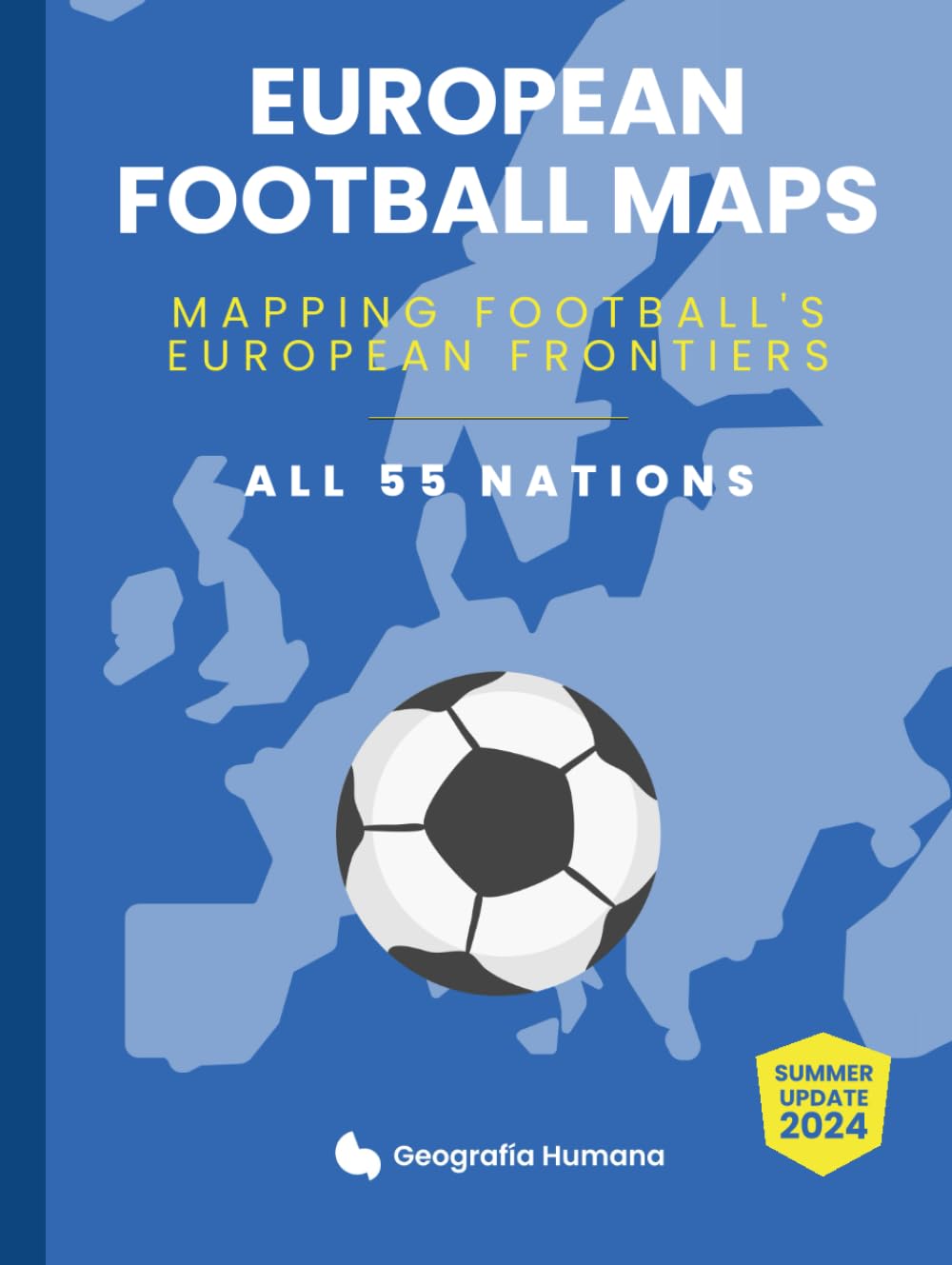
European Football Maps. Mapping Football's European Frontiers: Learn map by map the European National Football Teams, Clubs and Leagues of 55 countries. Hardcover – 30 March 2024
KASTWAVE Tapestry World Wall Map Mural, Decoration Vintage World Map Hanging Poster for Kids Student, Art Educational Background Wallpaper Wall Hanging for Living Room Home Office (39.3 x 59'' M)
Lonely Planet Budapest City Map
Lonely Planet Ireland Planning Map
Imagimake Mapology World Flags & Capitals Jigsaw Puzzle |75 Multi-Colored Country-Shaped Pieces | Birthday Gift for Boys and Girls| World Map Puzzle | Educational Toys for Kids 5,6,7,8,9,10
VeiVian World Map Tapestry, Map of World Vintage Topography Educational Tapestries Posters for College Kids Student Dorm Wall Art, Geographical Travel Map Tapestry for Bedroom Living Room, 60X40in