Swiftmaps Europe Wall Map GeoPolitical Edition SM EUR SM L
Lonely Planet Europe Planning Map
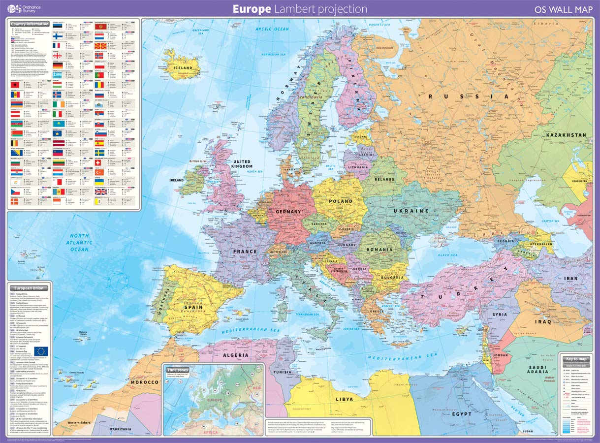
Europe: Lambert projection Map – 12 March 2020
Europe Map (National Geographic Adventure Map, 3328)
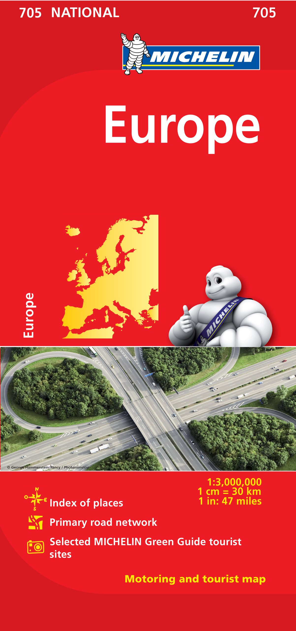
Europe - Michelin National Map 705: Straßen- und Tourismuskarte 1:3.000.000; Auflage 2023
2025 Philip's Big Road Atlas of Europe: (A3 Spiral Binding) (Philip's Road Atlases)
Rick Steves Europe Planning Map: Including London, Paris, Rome, Venice, Florence, Amsterdam, Vienna & Prague City Maps
KEIUNDJK Political Map - Map of Europe 2012 Thefreebiedepot Style 16x24inch(40x60cm)
Lonely Planet Global Limited Europe Planning Map
Maps International Large Europe Wall Map (political) - Front Sheet Laminated - 118.9cm (w) x 84.1cm (h) Map – Wall Map, 1 January 2019
Maps International Large Europe Wall Map (political) - Front Sheet Laminated - 118.9cm (w) x 84.1cm (h)
Europe Wall Map GeoPolitical Edition by Swiftmaps (18x22 Laminated)
Europe Map | Laminated | 70 x 100 cm Wall Chart – 1 January 2018
Philip's Europe Road Map (Philip's Sheet Maps)
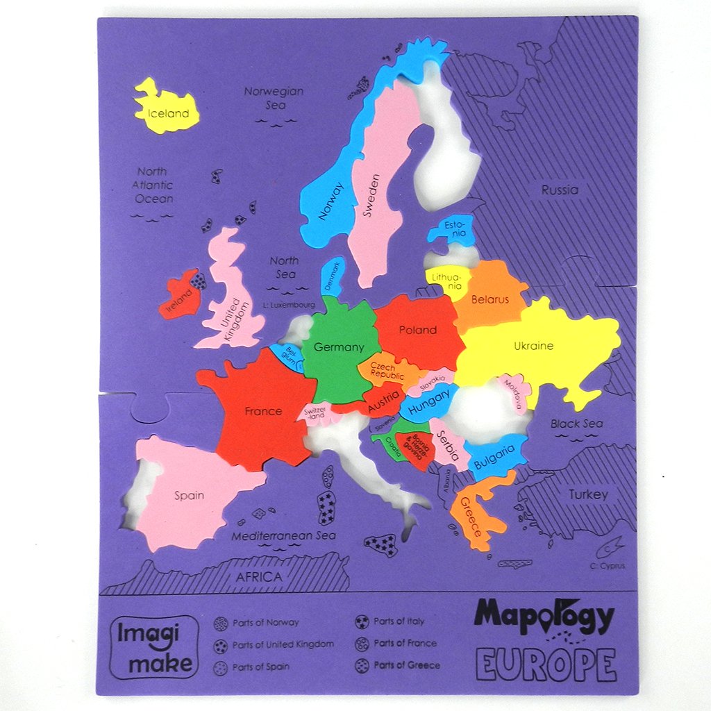
Imagimake Mapology: Europe Map Puzzle
Lonely Planet Europe Planning Map
Europe Wall Map Laminated GeoPolitical Edition by Swiftmaps A2 (42cm x 60cm)
GeoMetro - Large map of Europe (35 x 48 inches) full lamination, countries with the euro, members of the European Union Map – Wall Map, January 1, 2023
Michelin Road Atlas Europe (Atlas (Michelin)) Spiral-bound – November 1, 2017
Philip's Maps2025 Philip's Easy to Read Multiscale Road Atlas Europe: (A4 Spiral binding) (Philip's Road Atlases)
Rail Map Europe: 3rd Edition
Painless Learning M. Ruskin Europe Map Placemat (EUR-1)
Atlas & Green Scratch World Map + Scratch Map Europe Detailed Scratch World Map for Scratching in Mist Watercolour Map and Gift Tube
Imagimake Mapology Europe With Capitals- Learn European Countries Along With Their Capitals - Educational Toy For Kids Above 5 Years
KEIUNDJK Political Map of Europe Poster Style-1 16x24inch(40x60cm)
Europe - Middle East - Central Asia Political Road Map 1:5 500 000
SMALL - 100 EUROPE POLITICAL OUTLINE MAP FOR SCHOOL| Europe Political map
Imagimake Mapology: Europe Map Puzzle for Baby
Philip's Europe Road Map (Philip's Sheet Maps)
Europe Map Classroom Poster - EXTRA LARGE 33” x 23.5” - Laminated - Map of Europe Geography Class Decoration - Wall Chart by Daydream Education.
2025 Philip's Big Road Atlas of Europe: (A3 Spiral Binding)
Set of Large Size 100 Practice Educational Blank Outline Maps of World / India / Continents Asia, Europe, AUS, North America, South America, Africa Political and Physical 11 Inches X 9 Inches
Lonely Planet Europe Planning Map: Why We Can't Agree and Why We Should
Streetwise Europe & Major Rail Routes Laminated Map (Michelin Streetwise Maps)
Map of Europe 18x24 - Laminated Wall Map Poster Print Perfect for Classrooms and Homes - Vivid Imagery with Bright Colors
Europe Classic, Tubed: Wall Maps Continents
Michelin Europe Map 705 (Maps/Country (Michelin))
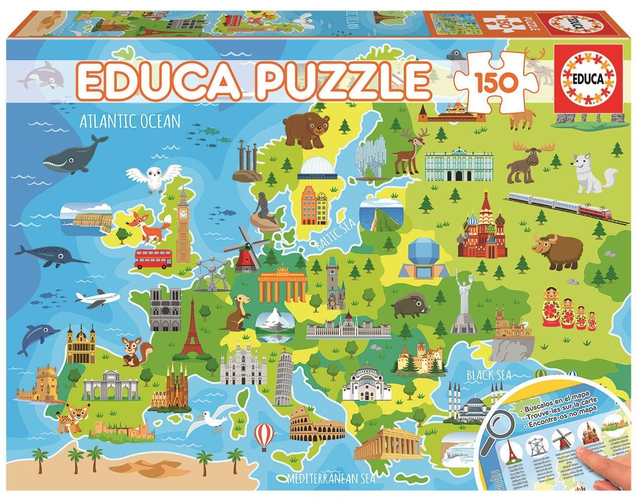
Educa18607 Map of Europe, 150 Pieces Puzzle for Children from 6 Years, Map, Learning Puzzle
National Geographic Europe Map (folded with flags and facts) (National Geographic Reference Map)
Luckies of London Scratch off Map World Poster, Detailed Map of the World with capitals, states, cities, Scratch Map Deluxe Edition
SMALL - 100 EUROPE POLITICAL OUTLINE MAP FOR SCHOOL and SMALL 100 EUROPE PHYSICAL OUTLINE MAP FOR SCHOOL | Combo of 2
National Geographic: Europe Classic Enlarged Wall Map (46 x 35.75 inches) (National Geographic Reference Map)
National Geographic: Europe Classic Wall Map - Laminated (30.5 x 23.75 inches) (National Geographic Reference Map)
Jigsaw Puzzles For Adults 1000 Piece Map Of Europe Puzzle - European Jigsaw 1000 Piece Jigsaw Puzzles For Adults And Kids - Geography Gifts by bopster
Grupo Erik Physical Political Map of Europe ES Poster - 36 x 24 inches / 91.5 x 61 cm - Shipped Rolled Up - Cool Posters - Posters & Prints - Wall Posters
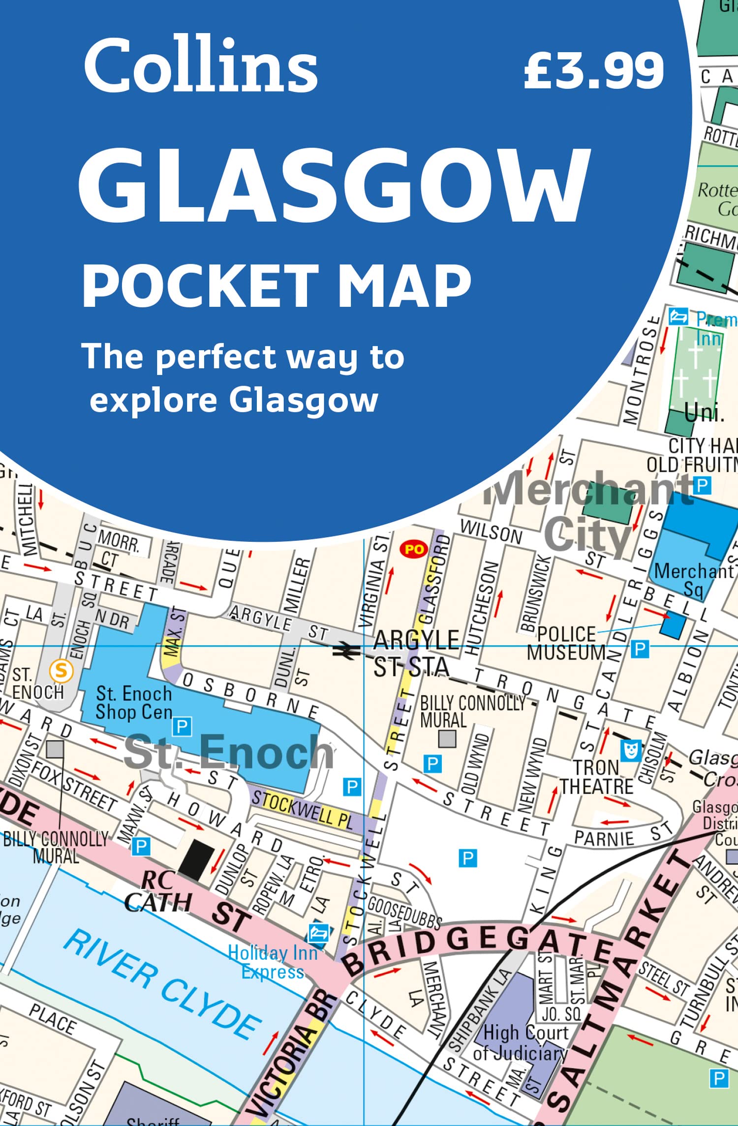
Glasgow Pocket Map: The Perfect Way to Explore Glasgow
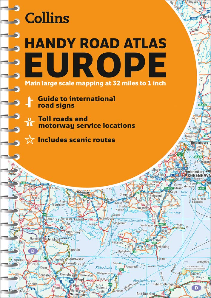
Collins Handy Road Atlas Europe
Global Walkabout Scratch Off Europe Map with Flags background – Deluxe Travel Size European Map Poster – Countries and Facts – Travel Gift (Black) Unknown Binding
Skye Pocket Map: The Perfect Way to Explore Skye
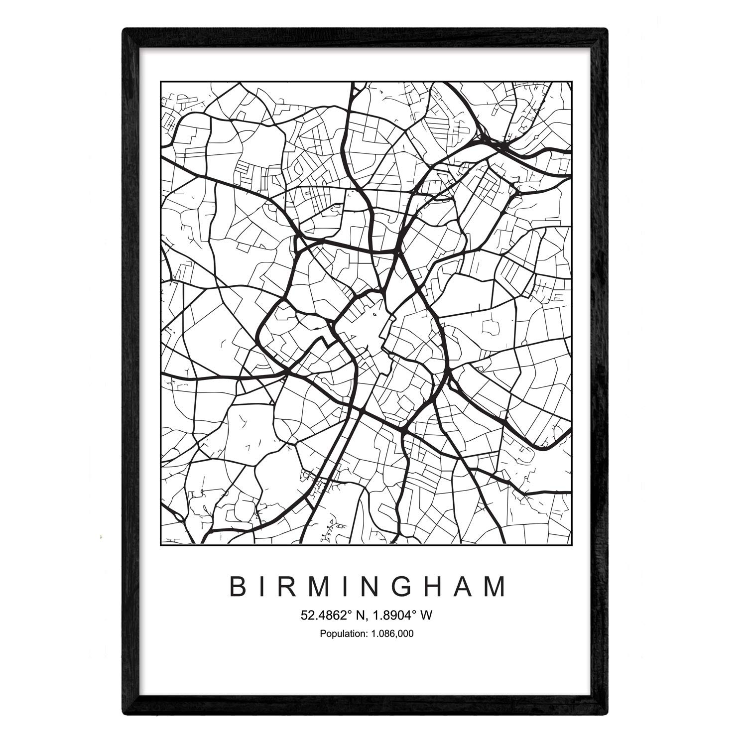
Nacnic Poster City Map of Birmingham city | Minimal Nordic style in black and white | Print of city map in Europe | A3 size | Decor for room, walls, office, shops
Rail Map Europe - Alpine Special: Specifically designed for Global Interrail and Eurail RailPass holders
DAYONG Scratch Off Word Map, Scratch Off Map with Scratcher and Brush, 82x60CM Scratch Off Travel Poster, Travel Map Wall Art Gift for Outdoor Enthusiasts
The Family Tree Historical Maps Book - Europe: A Country-by-Country Atlas of European History, 17 Hardcover – Atlas, 13 April 2015
Scratch the World® Travel Map - Scratch Off World Map Poster + BONUS Europe Scratch Map - Maps International - 50 years + of map making - Most Detailed Map Gift
History of Ireland in Maps
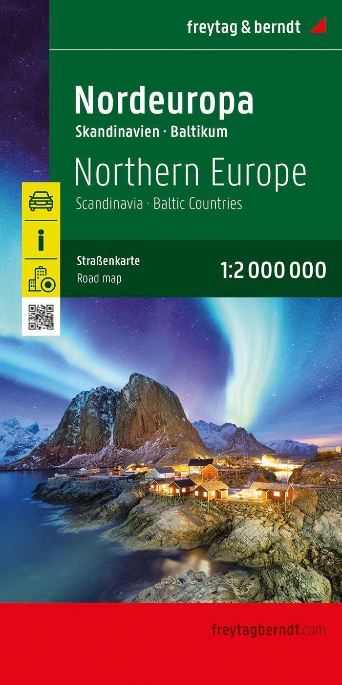
Northern Europe - Scandinavia, Baltic countries road map 1:2
KASTWAVE Tapestry World Wall Map Mural, Decoration Vintage World Map Hanging Poster for Kids Student, Art Educational Background Wallpaper Wall Hanging for Living Room Home Office (39.3 x 59'' M)
Europe Physical Road Map 1:3 500 000
WIDETA Scratch off world map (82 x 43 cm), Including Europe map and accessories
2016 Collins Essential Road Atlas Europe [New Edition]
Imagimake Mapology World Flags & Capitals Jigsaw Puzzle |75 Multi-Colored Country-Shaped Pieces | Birthday Gift for Boys and Girls| World Map Puzzle | Educational Toys for Kids 5,6,7,8,9,10
Re-marks Map of Europe, 850-Piece Jigsaw Puzzle for All Ages
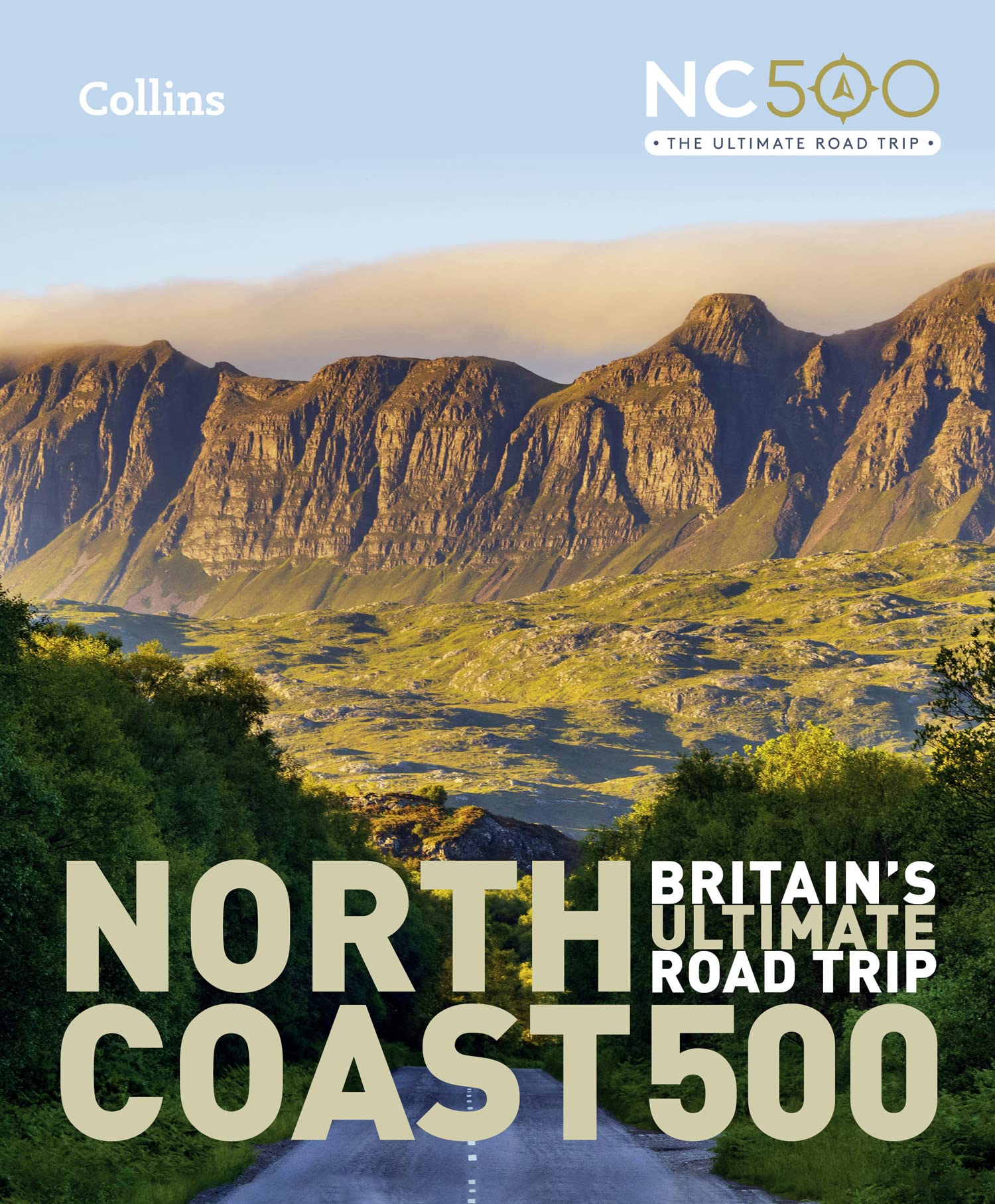
North Coast 500: Britain’s ultimate road trip
Scratch Off Map Of Europe - Color Europe Wall Map - Scratch Off - 33 x 23
Splosh Travel Map - Large Europe Map Pin Board in Grey, Wooden Frame. Map of Europe with 100 Pins in 2 Colours to Mark Your Past & Future Adventures, Map of Europe for Travel Planning, Home Decor.
Picos de Europa NP 3 maps + guia ES (6)
Independently published Europe Map Coloring Book: Political Maps of European Nations
Educa - New Maps - Map of Europe - 1000 Piece Jigsaw Puzzle - Puzzle Glue Included - Completed Image Measures 26.77" x 18.9" - Ages 14+ (19624)
Europe Map | Geography Posters | Gloss Paper measuring 850mm x 594mm (A1) | Geography Classroom Posters | Education Charts by Daydream Education
Rick Steves Europe Planning Map: Including London, Paris, Rome, Venice, Florence, A
Miss Wood Woody Map XL Cork Map with Europe Design - Brown
Europe Map Flat in a Tube 1:3 500 000
Balkans - South-East Europe Road Map 1:2 000 000
Map of Europe Childrens Pupils Teachers Classroom Display Poster A2 Primary Teaching Services
Old Map of the World Tapestry Wall Hanging, Medieval Europe Retro World Map Vintage Earth Hemisphere Posters Office Wall Decor Tapestries, Renaissance Nautical Chart Map Tapestry for Bedroom Dorm Home
2004 map Europe|Size 20x24 - Ready to Frame| Europe
Grupo Erik editores Europe Map Poster 61 x 91.5 cm
Continental Series: Europe - Wall Map
Europe - Tourist and Motoring Atlas (A4-Spiral): Tourist & Motoring Atlas A4 spiral
Europe Map (National Geographic Adventure Map) (National Geographic Adventure Map, 3328) Map – Folded Map, 4 Dec. 2017
Painless Learning Educational Placemats Sets USA Africa Asia and Europe Maps Non Slip Washable
Detailed Scratch Off Map of The Europe - Easy to Frame 24 x 16 European Travel Map Poster with Cities - Large Black and Gold Push Pin Travel Wall Maps - Scratchable Europe Map with Scratcher Included
Maps International Giant World Mural – Mega- Of The World - Classic Tones - 232 x 158
Daydream Education Europe Map | Geography Posters | Laminated Gloss Paper measuring 850mm x 594mm (A1) | Geography Classroom Posters


![2016 Collins Essential Road Atlas Europe [New Edition]](https://m.media-amazon.com/images/I/61jjljADmDL.jpg)