Your One-Stop Destination for Historic Pictoric
Explore the finest Historic Pictoric products crafted for quality, innovation, and style.

Historic PictoricMap - Maine 1897 - The Century Atlas World - Vintage Poster Art Unframed- 24in x 18in
164 Br

Historic PictoricPorsche Race 1975-24in x 18in Vintage USA Poster Print
164 Br

Historic PictoricBlueprint Small Sconce Details - G. B. Cooley House, 1011 South Grand Street, Monroe, Ouachita Parish, LA 24in x 16in
1 969 Br

Syracuse History Calendar
395 Br

Historic Pictoric Vintage Map - Admiralty Inlet and Puget Sound, WA, 1983 Nautical NOAA Chart - Vintage Wall Art - 24in x 36in
819 Br

Historic Map - Augusta National Golf Club Course, 1954, Augusta National Golf Club - Vintage Wall Art 18in x 24in
359 Br

Historic Map - Augusta National Golf Club Course, 1954, Augusta National Golf Club - Vintage Wall Art 24in x 30in
754 Br

Historic Map - Map of The World, 1587, Urbano Monte - Vintage Wall Art 24in x 24in
754 Br

Historic Pictoric Map, 1903 Lake Winnipesaukee, New Hampshire, Vintage Wall Art : 36in x 24in
348 BYN

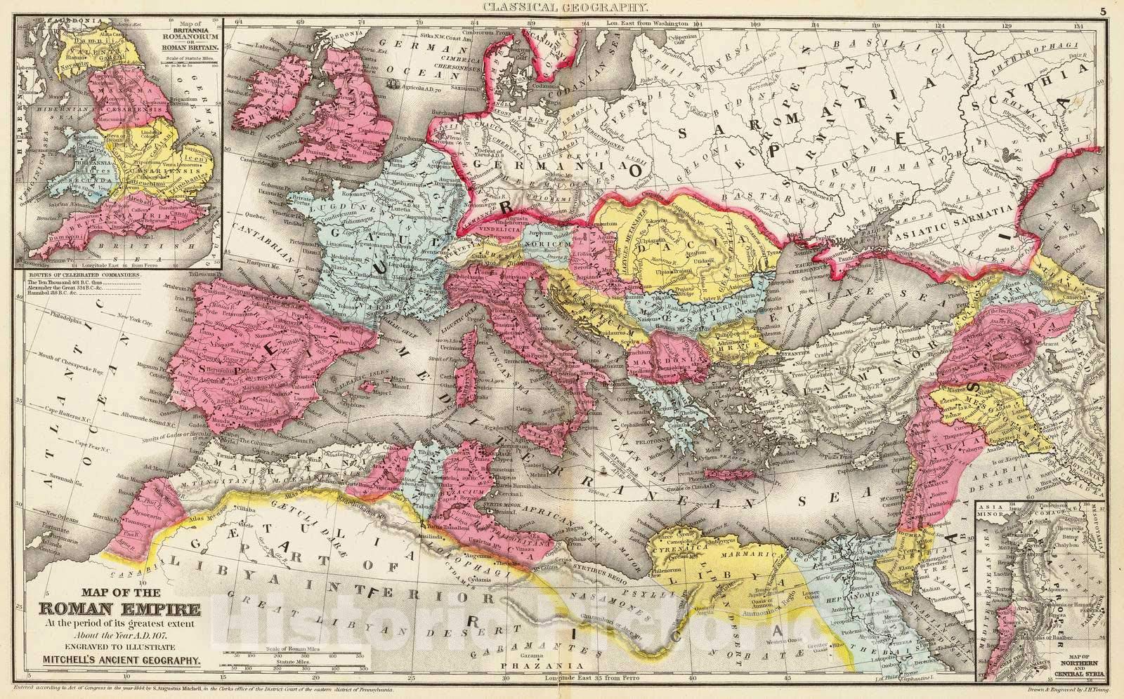
Historic PictoricMap : Rome, Eastern Hemisphere Map of The Roman Empire at The Period of its Greatest Extent About The Year A.D. 107, 1875 Classical Atlas, Antique Vintage Reproduction : 44in x 28in
390 Br

Know the Bible in Thirty Days
124 Br

Historic Pictoric Wall Map, World - Ocean Floors and Land Relief. 1976 - Vintage Wall Art - 44in x 28in
1 199 Br

Historic Map - Augusta National Golf Club Course, 1954, Augusta National Golf Club - Vintage Wall Art 18in x 24in
704 Br

Historic Pictoric Map - Austria & Hungary & Czech Republic & Slovakia & Slovenia & Bosnia & Poland 1914 Century Atlas - Vintage Poster Art Reproduction - 24in x 18in
939 Br

Historic Pictoric World War II map. by Stanley Turner, 1943 - Vintage Wall Art - 36in x 24in
348 BYN

Historic PictoricFine Art Print - Currier & Ives - Central Park in Winter - Vintage Wall Art - 11in x 14in
163 Br

Historic Map - Map of The World, 1587, Urbano Monte - Vintage Wall Art 24in x 24in
504 Br

Know the Bible in 30 Days: Discovering Historical Facts, Biblical Insights and the Inspiring Power of God's Word
112 Br

Historic PictoricMap : A Chart of The Chesapeake and Delaware Bays, 1862, Vintage Wall Art : 24in x 36in
1 129 Br

Historic Pictoric Map, 1914 Bartholomew's Chart of The World on Mercator's Projection, Vintage Wall Art : 36in x 24in
864 Br

Historic Pictoric Map : Negroland, adjacent countries., 1747, Vintage Wall Art : 44in x 36in
500 Br

A Man for All Seasons
132 Br

Historic Pictoric Map : The Land of Make Believe. Published by Jaro Hess 1930, 1930, Vintage Wall Art : 36in x 24in
864 Br

Historic PictoricBlueprint Sconce Details - G. B. Cooley House, 1011 South Grand Street, Monroe, Ouachita Parish, LA 12in x 08in
1 339 Br

Historic Pictoric A Map of North Carolina for Nature Lovers The Garden Club of North Carolina, 1937 - Vintage Wall Art - 36in x 22in
304 Br

Historic Pictoric A Map of The United States Showing Boundaries Established After The Louisiana Purchase and Florida Acquisition.1784-1844. Published, 1958 - Vintage Wall Art - 30in x 24in
1 129 Br
